Sign up for our newsletter

Turns out some Colorado 14ers were lying about their height

share
An early 20th century photo from Louis Charles McClure shows the north side of Torreys Peak (elevation 14,264 feet) viewed from the Argentine Central Railway.
Photo courtesy the Denver Public Library Western History collection

LONGMONT, Colo. — By next year, Colorado’s tallest mountains will be shorter.

While a sudden shrinkage of the Rocky Mountains would be quite the geologic phenomenon, that’s not exactly what’s happening. Instead, the local sea level is rising.

Scientists have developed a more accurate method of measuring sea level that takes into account the effects of gravity, which will raise sea level in respect to the Colorado mountains by about a meter.
The National Geodetic Survey (NGS) finished collecting data for the remeasurement in 2022. Now, the NGS is testing a beta version of the system while they prepare national partners such as GPS companies and government agencies for the data change. The preparation should allow the organizations immediate access to the new data when the system goes live between 2025 and 2026.

More than just knocking the 14ers down a peg or two, the new measurements will help researchers make better floodplain maps and improve surveying across the country.

“In Colorado we know where the rivers are and we know if it rains a lot they'll flood. But it's only when it goes into a flat area that it gets complicated to predict where the water will go,” said Derek van Westrum, a Colorado physicist contributing to the mountain remeasurement. “Having maps that include the gravity effect of water will be priceless.”

Yet, several local residents have feared the height reduction would put mountains such as Sunshine Peak, which sits at 14,004 feet above sea level, on the chopping block of the fourteener club.

“We won’t lose any fourteeners, which makes me really happy,” van Westrum said. “There’s some shifting of the order. The new lowest fourteener is Huron Peak.”

The Colorado 14ers are some of the most popular attractions in the state. The 58 mountains that make up the classification garnered an estimated 270,000 hikers in 2022. The popularity of the peaks unsurprisingly brought significant attention to the remeasurement.
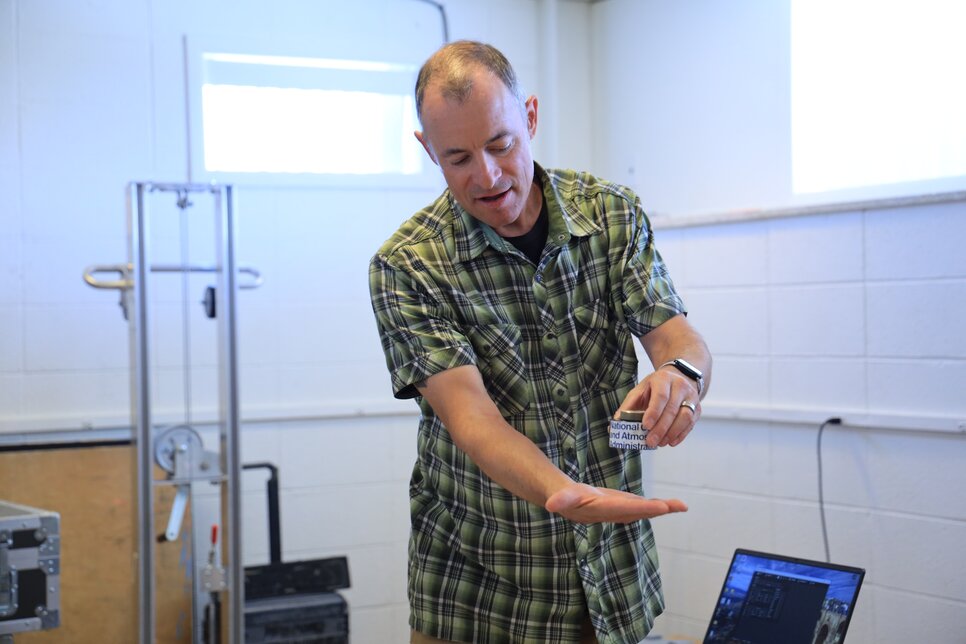
Van Westrum demonstrated the free weight mechanism of the Table Mountain Gravity Observatory’s (TMGO) absolute gravity meter.
Photo: Seth Jahraus, Rocky Mountain PBS
Well before gravity was considered a factor, Thomas Jefferson kicked off one of the earliest examples of sea level measurement in the United States. In 1807, Jefferson ordered the government to survey the Atlantic coastline in the hopes of creating an accurate map of the country.

After years of measuring the tide and coastal water levels, scientists found the mean sea level height, which became point zero for most altitude recordings at the time.

The original method of measuring height above sea level was rudimentary.

“It's usually one person with a tripod, with a telescope in the middle, looking at two people on either side with rulers,” said van Westrum. “They're keeping track of height differences from some starting point to some end point.”

After years of scientists marching with telescopes and rulers, the NGS created a standard benchmark in Quebec, Canada that averaged all of the official altitude recordings. Called the North American Vertical Datum of 1988, it's what all vertical measurements in Canada, the U.S. and Mexico are based on.

But there are a few problems with this methodology. 

Primarily, the Earth is constantly moving. With a singular point literally set in stone, there is a chance that after many years of a changing landscape, the measurement could be off by a few feet.

GPS advancements helped make these changes more manageable because there was no longer a need to march outwards from the shore to get an accurate measurement of the height above sea level. 

However, the GPS becomes less accurate in more mountainous areas such as Colorado. That’s because it fails to take into account the forces of gravity.
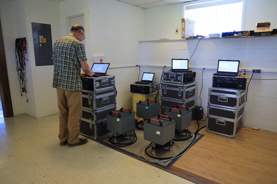
Van Westrum monitors a group of laptops displaying live gravity readings from PhoneX gravity meters.
Photo: Seth Jahraus, Rocky Mountain PBS
Water, like everything else, is subject to gravity. Van Westrum gave the example of a flat lake bed with a mound of heavy gold on one end.

“If you pour the water into the lake bed, you would think at first, ‘Oh, it's a flat lake bed, the water won't flow anywhere,’ but actually the gravity of that extra gold will pull the water horizontally,” said van Westrum. 

“It looks magical.”

The Colorado mountains have so much mass that they have their own gravitational pull, much like the glob of gold. As van Westrum puts it, if the sea cut into the land and extended until it was well beneath the topography of the Rocky Mountains, it would be higher by a few feet due to the upwards gravitational attraction of the landmass.

While there is some merit in knowing the exact dimensions of the Colorado mountains (and the security of their 14,000-foot placement), there’s more to the research than correcting a more than two mile high land mass by a couple of feet.

The amount of uncertainty behind many vertical measurements will go from a few feet to a couple of centimeters. The new readings will make actions such as plane landings and boat dockings significantly easier, where the success of the endeavor quite literally comes down to a few inches.

The remeasurement also has potential to improve future automated systems. Self-driving cars and transportation vehicles can use it to better their internal maps and guidance tools.
Researchers use gravity monitors (pictured) carried in airplanes to take gravity recordings over the Rocky Mountains.
Photo: Seth Jahraus, Rocky Mountain PBS
Despite the benefits of the new data, the potential loss of one of the state’s beloved fourteeners was enough to create some public concern. 

The official NOAA website even published an article back in April reassuring everyone of the security of their mountains.

“A peak that's 13,998 (feet) is just not going to have the appeal as something that's 14,004 (feet),” said Lloyd Athearn, the executive director of the Colorado Fourteeners Initiative.

Athearn and the Colorado Fourteeners Initiative seek to “preserve and protect” the Colorado mountains that hold the 14,000-foot classification.

“To give an example of how obsessive people get about this, a number of years ago we did an April Fool's post through our social media channels,” Athearn said.

The social account posted an update on the Initiative’s trail work that said they had started to quarry off rock from the summits of the peaks, reducing several of the mountains down to “thirteeners.” The post commended the organization for finding a way to promote ecological growth by disincentivizing potential hikers and reducing human impact.

“Some people just lost their minds, like, ‘Are you crazy? You can't do that. You can't take away our fourteeners,’” Athearn said. “It gives you insight into just how people love these places and just feel a real passionate attachment to them.”
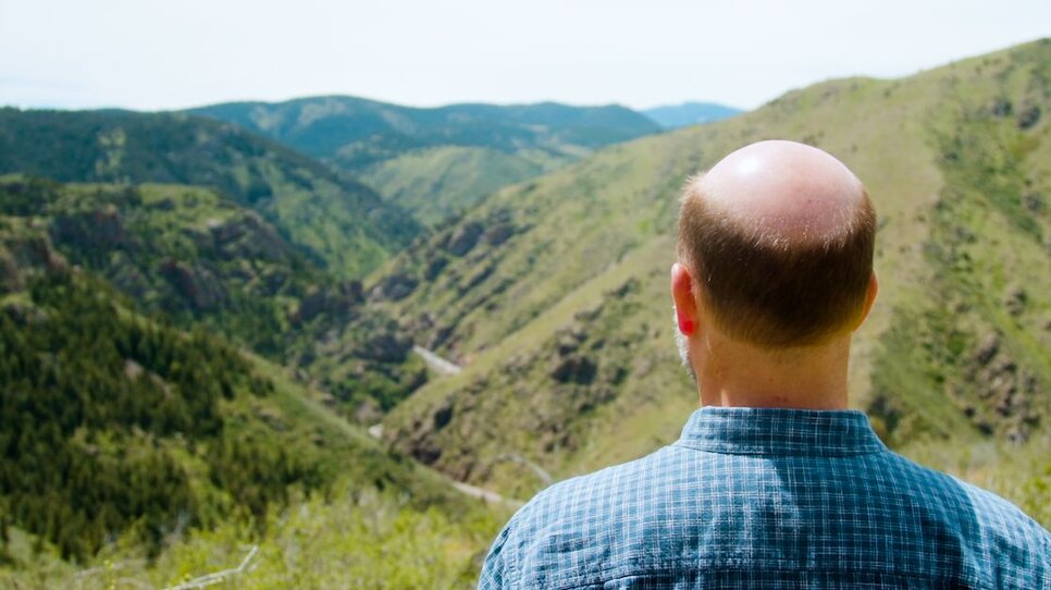
Athearn enjoys a valley view from Lookout Mountain near Golden, Colorado.
Photo: Chase McCleary, Rocky Mountain PBS

Fourteeners are a Colorado-specific designation, according to Athearn. They are some of the few mountains in the United States that reach above 14,000 feet and are still feasible to climb for intermediate hikers, unlike mountains such as Mount Rainier which require a more advanced hiking background.

Athearn called the fourteeners an “accessible Everest.”

The popularity associated with the mountaintops creates a significant amount of foot traffic. The volumes of hikers means any hikes that occur off the designated trails can cause serious damage.

“You can have plants that are 40, 50 years old that might only be a few inches off the ground, and they are uniquely adapted to being there, but they're poorly adapted to having people step on them,” said Athearn. “Sometimes as few as five to 10 steps can kill a plant or set back its growth dramatically.”

Athearn challenged the idea that mountains have “durable, rugged peaks.” When the vegetation holding down the soil is torn up, the environment becomes increasingly susceptible to the effects of erosion.

“You have soil in the alpine. Takes about 1,000 years for an inch to develop, right? Wind blows dust and other things,” said Athearn. “If you have something that took 1,000 years to develop and then a major thunderstorm or spring snowmelt event, you might have 1,000 years of process just sweeping down the hillside.”

The new measurement system won’t be restricted to professionals and government agencies. According to van Westrum, GPS centered programs such as navigation and trail apps on your phone will also utilize the system once it goes live, meaning you’ll have the new data available at your fingertips.

Curious hikers could see evidence of the height change first hand if they were to climb to the top of one of the many 14,000-foot Colorado peaks in the next year.

While climbers will be able to keep a close eye on the corrected altitude as they traverse up the mountains, the Colorado Fourteeners Initiative should encourage them to keep an eye on the trail as well. You never know how many years of progress one wrong step can stunt.

Over a million Coloradans turn to Rocky Mountain PBS to discover provocative and inspiring local, national and international programming; find diverse viewpoints; score front row center seats to world-class performances; and experience lifelong learning opportunities every month.

Contact with us

Contact

Audience Services

Mail

Address

Buell Public Media Center

2101 Arapahoe St.

Denver, CO 80205

Legal

Thank you to the Buell Foundation, Bonfils Stanton Foundation and Koelbel & Company.

This site uses cookies for continuous music streaming.

© 2024, All Rights Reserved