Why do the Book Cliffs look like that?
share

GRAND JUNCTION, Colo. — The rocks that make up the Book Cliffs north of Grand Junction once covered the whole valley. Before that, the whole Rocky Mountain region was underwater.
“If we could go back, let's say 10 million years ago, the rocks that are forming that cliff behind me, we would be underneath those rocks because that is an erosional cliff,” said Rex Cole, professor emeritus of geology at Colorado Mesa University and member of the Grand Junction Geological Society.
“Over the last 10 million years, the cliff has been moving off to the north because of erosion,” Cole said.
The shapes created by the slow, but never ending, erosion of the sandstone cliffs bring to mind a collection of books perched on a shelf.
The local geological society hosts monthly meetings at CMU, where people passionate about geology catch presentations on a wide range of topics related to earth science. Many members are students and professors conducting field research in nearby areas like the Uncompahgre Plateau.
“It was organized officially in the mid 1950s around the uranium boom time period [in western Colorado], it's been in continuous operation since,” said Jay Scheevel, a consulting geologist in the oil and gas industry who has been a member of the geological society for more than 20 years.
“It's basically an opportunity for the geologists in the area to get together and compare notes,” he said.
In the desert between Fruita and Grand Junction, Cole stood about two and half miles from the cliffs that define the northern edge of the Grand Valley. He looked far off to the tall, graham cracker-colored sandstone that make up the Book Cliffs, and right under his hiking shoes, at the Mancos shale that makes up the ridged, gray dunes under the cliffs that reach out back to town and stop at corn and alfalfa growing canals.

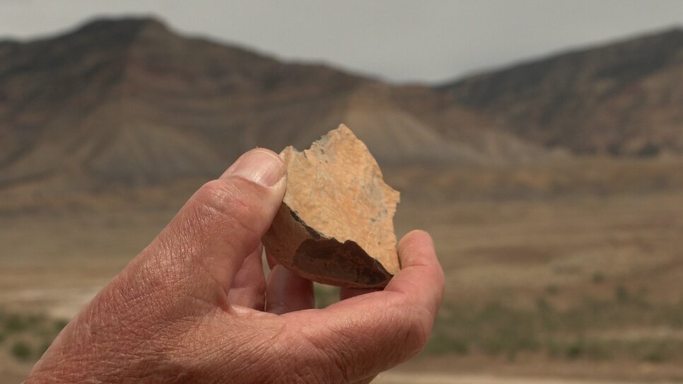
This piece of rock is an example of the Mancos shale that makes up the ground below the Book Cliffs. It was once mud at the bottom of an ocean.
Photo: Joshua Vorse, Rocky Mountain PBS
Photo: Joshua Vorse, Rocky Mountain PBS
“Back in what's called the Cretaceous period, this whole part of Colorado, in fact, the whole Rocky Mountain region was the site of a shallow seaway, and all of this Mancos shale that you're looking at here was deposited as sea bottom mud,” said Cole.
That was 60 to 70 million years ago. Shells and fossils in the dirt indicate to geologists that the land was once mud at the bottom of an ocean.
“The shale has a lot of fossils in it, and the fossils are squid like animals or clams or shark's teeth. So, the shale includes a lot of fossils indicative of how the original mud was deposited,” said Cole.
The GJGS is often involved in the geoscience department at Colorado Mesa University.
At a meeting in May, members listened to geology students give presentations on their research projects.
“They're usually sponsored by a faculty member. And most often somebody in the society is their faculty member or is contributing to their work or directing them a little bit,” said Scheevel.
The society also hosts field trips once or twice a year, for students to further brush up on their field work skills.
“[Geology] is a fantastic science because it's not really a science unto itself, it's an amalgamation of all sciences applied to a very complex system, which is the earth,” said Scheevel.
He says the cyclical nature of geologic events is why there are layers in the Book Cliffs.

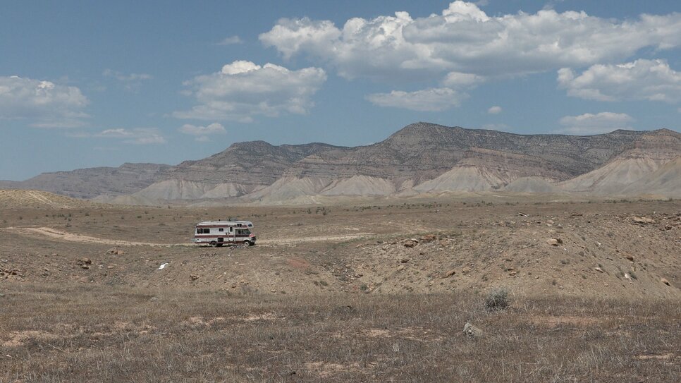
An abandoned motorhome sits in the desert north of Grand Junction with the Book Cliffs in the background. The geologic feature extends to the Colorado state line, and beyond into Utah.
Photo: Joshua Vorse, Rocky Mountain PBS
Photo: Joshua Vorse, Rocky Mountain PBS
“The rocks on the top of the Book Cliffs up there are sandstones, what we call shoreline or ocean margin type deposits. You have deltas and you have beaches and you have incised canyons that got backfilled with sand, that’s what makes the top of the cliffs, but it didn’t just happen once,” said Scheevel.
Geologists in the 1800s imagined the upturned pages of a book when surveying the Mancos shale and sandstone rocks north of Grand Junction, calling the formations the Book Cliffs.
The cliffs are home to pronghorn, rabbits, the occasional claret cup cactus and grazing cattle. They stretch out about 30 miles west to the state line and beyond into Utah. Heading east they morph into, and mingle with, the Roan Cliffs in the De Beque and Rifle area.

Tens of millions of years ago everything in the Grand Valley was under water, as the whole Rocky Mountain region was the site of an ocean.
Photo: Joshua Vorse, Rocky Mountain PBS
Photo: Joshua Vorse, Rocky Mountain PBS
But even in the massive, geologic time scales, everything is temporary.
“You can break a rock apart using a physical force, or you can just let rainwater mixed with oxygen and carbon dioxide chemically break down the rock,” said Cole.
The geological term is weathering.
“Everything we're walking on is in the process of being destroyed,” said Cole. “Slowly,” he added, after a pause.
